From Absolutism to
Napoleon (1648-1815)
INTRODUCTION
|
DOCUMENTS
|
IMAGES
|
MAPS
|
EDITOR
Maps
1-10 of 11 maps
return to list
|
next >
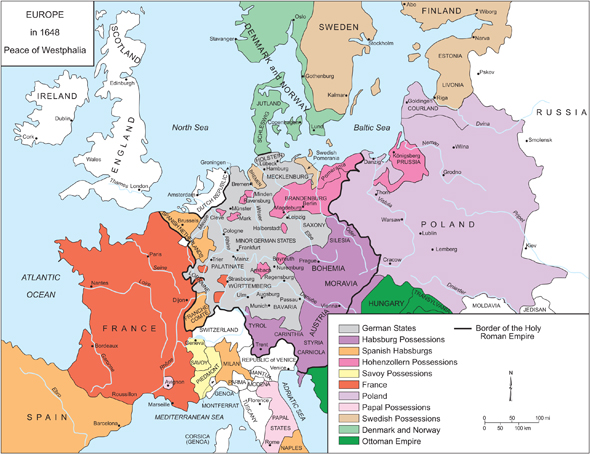
1.
Europe in 1648: The Peace of Westphalia
Please click on print version (below) for a larger version with enhanced resolution.
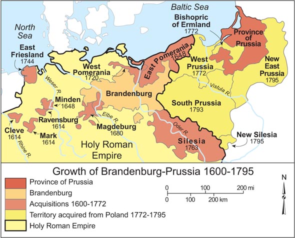
2.
Growth of Brandenburg-Prussia, 1600-1795
Please click on print version (below) for a larger version with enhanced resolution.
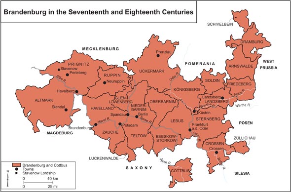
3.
Brandenburg in the Seventeeth and Eighteenth Centuries
Please click on print version (below) for a larger version with enhanced resolution.
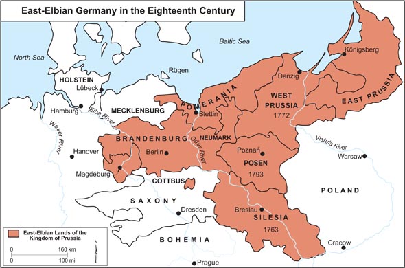
4.
East-Elbian Germany in the Eighteenth Century
Please click on print version (below) for a larger version with enhanced resolution.
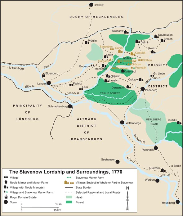
5.
The Stavenow Lordship and Surroundings, 1770
Please click on print version (below) for a larger version with enhanced resolution.
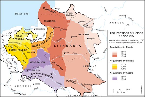
6.
The Partitions of Poland, 1772-1795
Please click on print version (below) for a larger version with enhanced resolution.
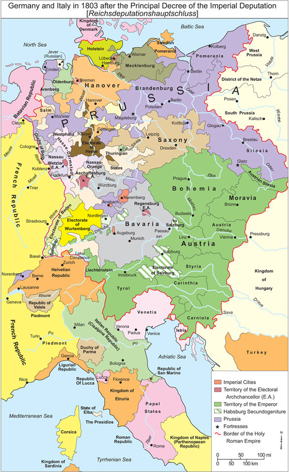
7.
Germany and Italy, 1803
Please click on print version (below) for a larger version with enhanced resolution.
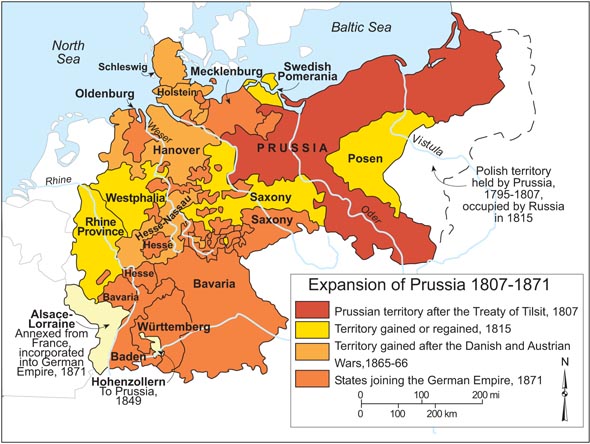
8.
Expansion of Prussia, 1807-1871
Please click on print version (below) for a larger version with enhanced resolution.
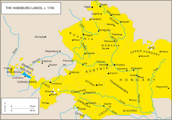
9.
Habsburg Lands, c. 1700.
Please click on print version (below) for a larger version with enhanced resolution.
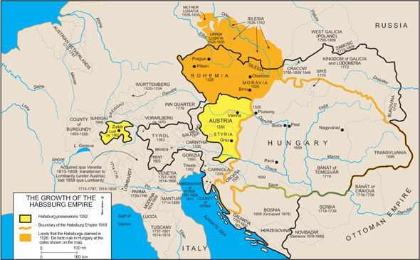
10.
The Growth of the Habsburg Empire
Please click on print version (below) for a larger version with enhanced resolution.
1-10 of 11 maps
return to list
|
next >


 return to list