| 1.
|
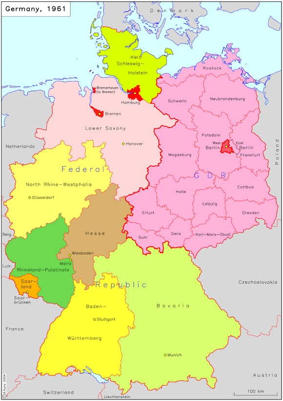
The Federal Republic of Germany and the German Democratic Republic (1961)
This map contrasts the federal structure of the Federal Republic of Germany with the centralized structure of the German Democratic Republic. The Federal Republic was made up of ten federal states....
|
|
| 2.
|
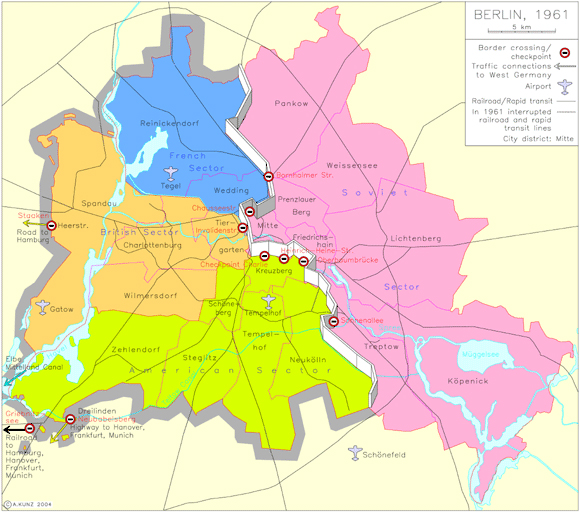
Berlin (1961)
This map shows the impact of the building of the Berlin Wall on August 13, 1961. Initially, the Wall sealed off the Soviet sector of the city (i.e., East Berlin) from the three Western sectors (West....
|
|
| 3.
|
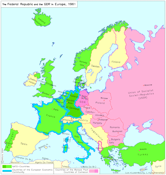
The Federal Republic of Germany and the German Democratic Republic in Europe (1961)
This map shows the integration of the two German states into Europe's military and economic blocs at the height of the Cold War in 1961. While the Federal Republic belonged to both the Western military....
|
|
| 4.
|
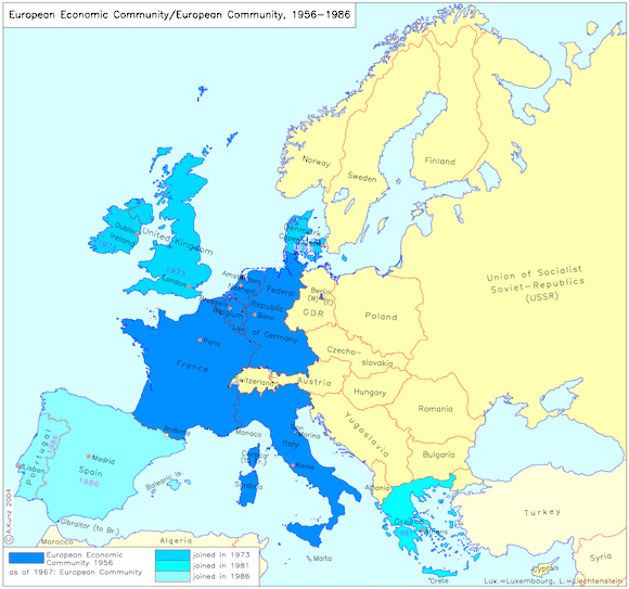
European Economic Community/European Community (1956-1986)
This map shows the development of today's European Union from its initial inception at the conference of the Council of Ministers of the European Coal and Steel Community in Venice in 1956 to the....
|
|
| 5.
|
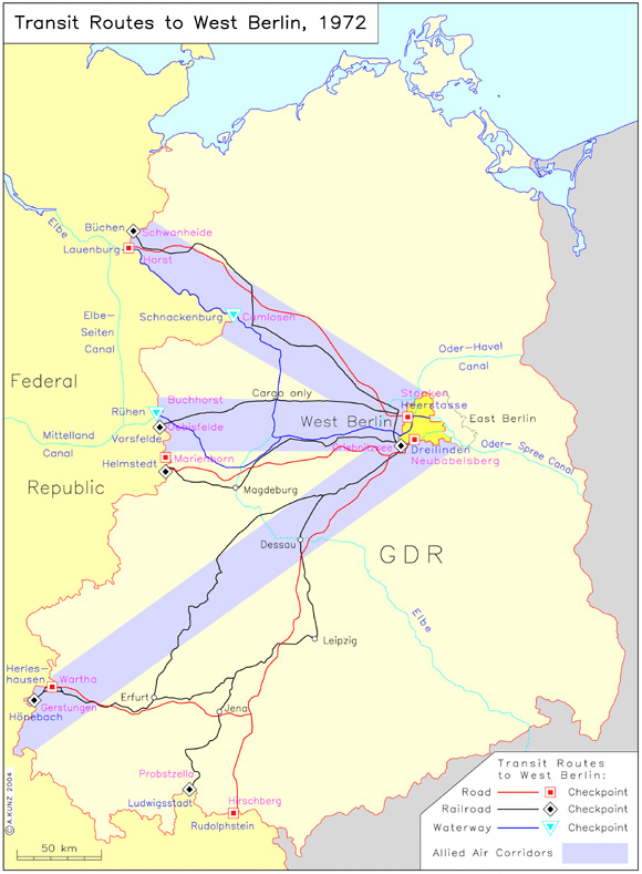
Transit Routes to West Berlin (1972)
The Basic Treaty of 1972 did not fundamentally alter transit routes to Berlin. The only changes that occurred were in the south. Two Autobahn checkpoints, Hirschberg and Rudolphstein (1972),....
|
|
| 6.
|
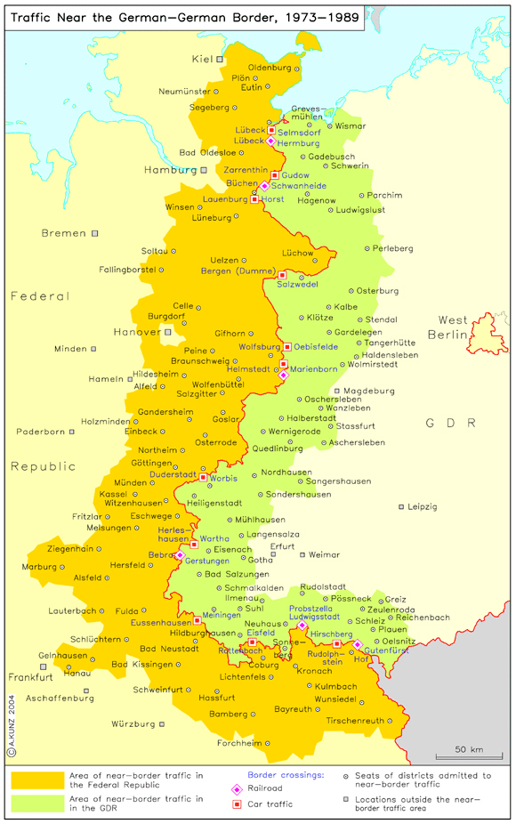
Traffic Near the Inner-German Border (1973-1989)
The Basic Treaty of 1972 improved opportunities for travel and visitation across the inner-German border. Residents of border regions on both sides (shown in color on the map) were given the right....
|
|


 return to list