| 1.
|
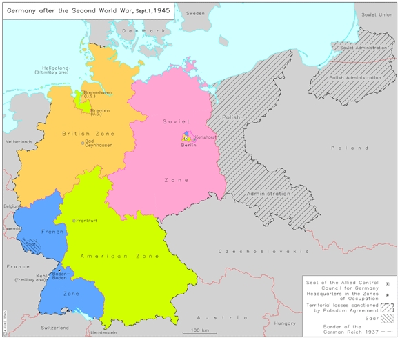
Germany after the Second World War (September 1, 1945)
This map shows the territories lost by Germany after the Second World War. It also shows the division of the new, smaller territory into Zones of Occupation. Allied troops had slowly begun occupying....
|
|
| 2.
|
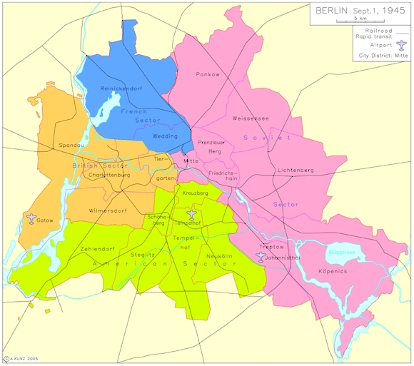
Berlin (September 1, 1945)
Following the conclusion of the Potsdam....
|
|
| 3.
|
States of Occupied Germany [Länder] (1947)
After the establishment of local governments in 1945, the founding of states [Länder] was the next step in the political rebuilding of Germany. The speed at which states were founded varied....
|
![States of Occupied Germany [<I>Länder</i>] (1947)](/images/Pix580_p947d_v2_GHI_E_a4_mb.JPG)
|
| 4.
|
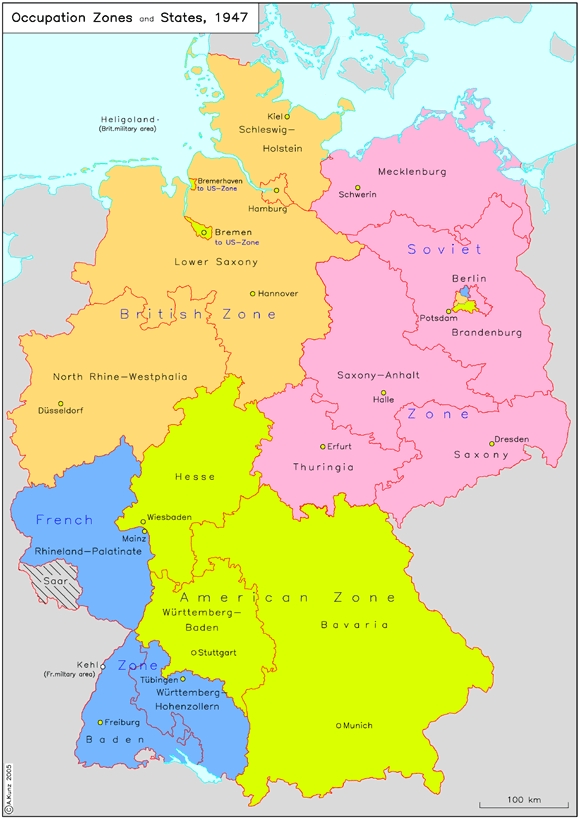
Occupation Zones and States (1947)
In this map, the states [Länder] are delineated, and the Zones of Occupation have been added in color. This helps show that the existing Zones of Occupation contributed to the difficulties....
|
|
| 5.
|
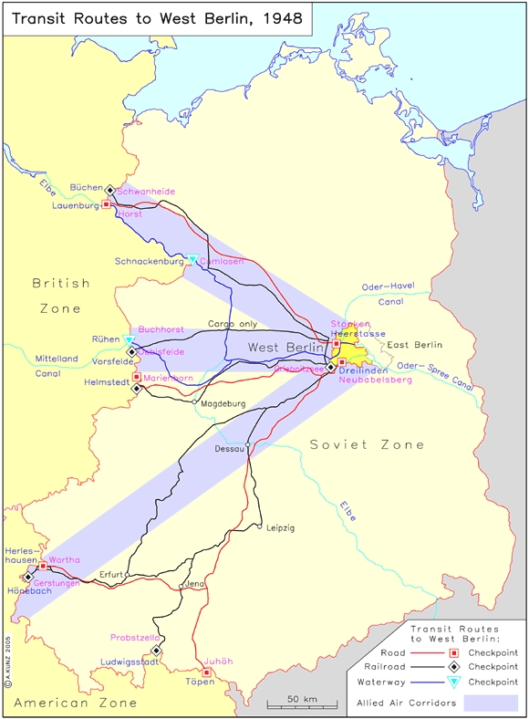
Transit Routes to West Berlin (1948)
As an island within the Soviet Zone of Occupation, West Berlin was connected with the British and American zones through precisely defined routes. This map shows the city's lifelines as of 1948.....
|
|
| 6.
|
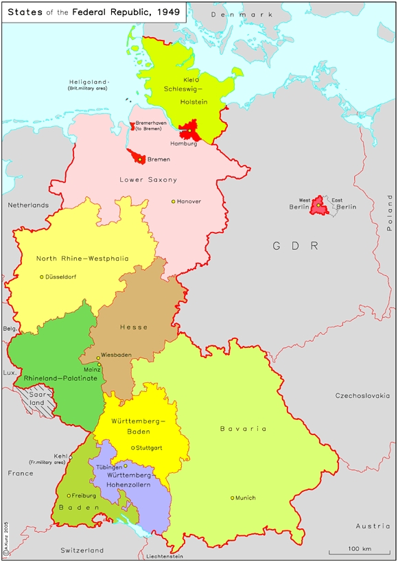
States of the Federal Republic (1949)
With the establishment of the Federal Republic in 1949, the eleven states that had belonged to the British and American Zones of Occupation became federal states [Bundesländer] in a government....
|
|
| 7.
|
States [Länder] of the German Democratic Republic (1949)
A second German state was formed on the territory of the Soviet Zone of Occupation in 1949, the German Democratic Republic. Its capital was East Berlin, a choice that was (and continued to remain)....
|
![States [<I>Länder</I>] of the German Democratic Republic (1949)](/images/Pix580_p949DDR_GHI_E_a4_mb.JPG)
|
| 8.
|
Districts [Bezirke] of the German Democratic Republic (1952)
In 1952, the GDR abolished its five states [Länder], which had been created in 1946-47. They were replaced with thirteen districts [Bezirke], which were named for their respective seats....
|
![Districts [<I>Bezirke</I>] of the German Democratic Republic (1952)](/images/Pix580_p952Bezirke_GHI_E_a4 copy.jpg)
|
| 9.
|
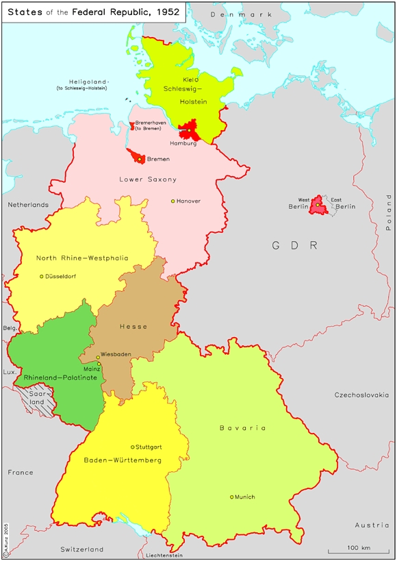
States of the Federal Republic (1952)
A consolidation of the federal structure was achieved with the founding of a new federal state, Baden-Württemberg, in the southwestern part of the Federal Republic. The Federal Republic of Germany....
|
|
| 10.
|
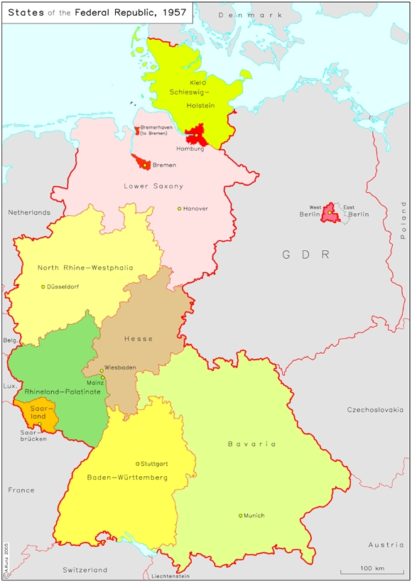
States of the Federal Republic (1957)
With the reintegration of the Saar region as the federal state of "Saarland," the development of the Federal Republic was provisionally completed in 1957. Until 1990, the Federal Republic was comprised....
|
|


 return to list