INTRODUCTION | DOCUMENTS | IMAGES | MAPS | EDITOR
|
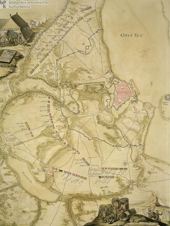
Stralsund, a former Hanseatic city, is a Baltic seaport on the Strelasund strait opposite the island of Rügen. The citizens of Stralsund adopted the Protestant faith early on and therefore sided with Sweden in the Thirty Years War (1618-1648). Under the Treaty of Westphalia (1648), Stralsund was ceded to Sweden, along with the rest of western Pomerania. During the seventeenth and eighteenth centuries, Stralsund’s history was one of repeated besiegement and successful resistance. In 1628, the city famously resisted a long siege by Albrecht von Wallenstein. The city was less successful in warding off a prolonged attack by Prussian, Saxon, and Danish troops in 1715. The siege lasted from July to December and ended in Swedish defeat. Made by and for the victors, this diagram commemorates that siege. The drawing dates from 1718, three years after the siege took place. The 1715 siege of Stralsund took place within the context of the Second Northern War (1700-1721), which was primarily a struggle over hegemony in the Baltic region between Sweden, on the one hand, and Russia, Denmark-Norway, and Saxony-Poland on the other. Although the death of Swedish king Charles XI (r. 1660-1697) and the subsequent accession to the throne of his fourteen-year-old son Charles XII (r. 1697-1718) provided the immediate impetus to the formation of the anti-Swedish coalition, the Second Northern War represented the continuation of a tradition of resistance to Swedish dominance in northern Europe dating back to the Thirty Years War.
© Bildarchiv Preußischer Kulturbesitz / SBB |
 print version
 return to image list
 previous image